
"HIDDEN HISTORY" Walking tour
THE PAST IS ALL AROUND US. WE JUST HAVE TO SLOW DOWN AND LOOK FOR IT!
MOUNT HOREB'S "HIDDEN HISTORY" WALKING TOUR
A walk around the Village can be a trip through the past. Whether you are retracing familiar routes or venturing into neighborhood territories new to you, you have undoubtedly been traveling on, through and by local history. It’s pretty hard to avoid. Mount Horeb’s story began with immigrant arrivals nearly 200 years ago, and with thousands of years of American Indian occupation before that—you really can’t help but walk someone else’s path!
|
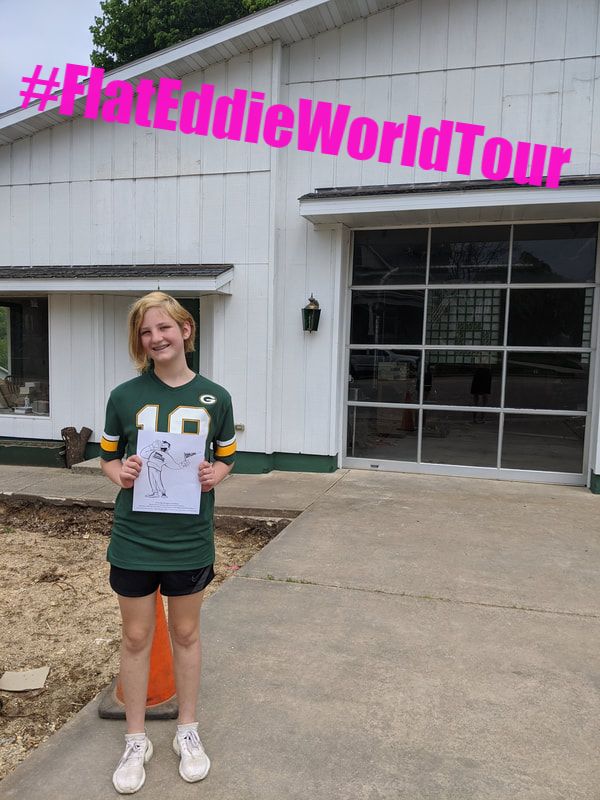
Don't Forget Eddie!
(We wouldn't send you without an official tour guide!) 
Eddie the Explorer,
the Driftless Historium’s intrepid friend to the curious-minded, is ready to join your adventure! Print your own Flat Eddie Travel Buddy by downloading the above PDF. Cut him out, color him, or just take him along for the ride! 
|
The Mount Horeb Area Historical Society challenges you to seek out twelve “Hidden History” checkpoints, and learn more about your hometown at the same time!
PART 1 OF 2 The route for “Hidden History: Part 1” follows Main Street. (Note: this route is approximately 1.5 miles round-trip. We suggest you consider starting downtown, ending at Premier Co-op and come back along the Military Ridge Trail.) 1. The Dahle Brothers, Herman and Ted, built their general store at the corner of Main and Second Streets in 1887 to supply the residents of Mount Horeb with a wide range of goods. To find Herman and Ted’s building, look for all that remains of a painted sign on the side of their store that once said “DAHLE BROS. MERCHANDISE”. 2. Can you find Mount Horeb’s first bank building? It’s located between First and Second Streets and, if you keep your eyes up high, you’ll find a clue that will tell you which building it is. Hint: it’s definitely not the tallest building in the village. 3. Mount Horeb used to have two theaters! One of them, the Parkway Theater, was at the corner of Main and Grove streets. The very long building allowed room inside for movies, theater performances, and a dance hall. To find it, look for the diamond-shaped designs on the side of the building. 4. The first gas station in the village of Mount Horeb was along West Main Street. In the 1930s, this was replaced with a larger gas station that had two bay doors. The building was later used by the Mount Horeb Fire Department to store old fire engines. Can you find an old lamp post from the time of the gas station—it’s bright red! 5. The bell from the old Blue Mounds Methodist Church (now a private home in Blue Mounds) is in the care of the Immanuel Lutheran Church at 310 West Main Street. If you stand on the sidewalk in front of ILC, can you see the bell? 6. The Military Ridge State Trail that many of us walk and bike on was once the line of tracks for the Chicago & Northwestern Railway, part of a rail system that linked eight states in the Midwest and Great Plains. Some relics of the railroad are still around; look for a railroad switch stand near Premier Co-Op. This device, with red and green signs, was used by the conductor to move railroad cars onto a side track for deliveries. PART 2 OF 2 This route begins in downtown Mount Horeb. Walk south on Second Street, then turn east onto the Military Ridge State Trail. This circular walk is approximately 1.8 miles. To help keep you on track, italicized route directions are included. Follow them after you locate each checkpoint. 1. Can you find one of the oldest trees in Mount Horeb? Look for this mammoth tree nearby at the point where you’re walking the Trail and you encounter a sidewalk. How old do you think this tree is? Nobody knows for sure, but just think—this guy’s watched Mount Horeb grow up! Now walk south on Fourth Street. 2. There was once an old village postal box at a corner of Fourth Street and another street. The box itself is gone, but the concrete post that once supported the post is still stands. Can you find it? It blends in to the shadows of the trees, so look close! Now go back to the trail and continue to walk east along the trail. 3. Liberty Park contains an object even older than the Civil War, though it may have been used during the war. Hint: it was made in 1846 and it’s probably very heavy! Can you find it? Now walk to Springdale Street and turn left; head toward the roundabout. 4. The oldest part of Mount Horeb, today called “Old Town,” was near the Kwik Trip roundabout. Even back then, Baby Mount Horeb had several stores, a blacksmith shop, churches and a school, all standing within a couple blocks of this much-travelled (even back then!) intersection. And the cemetery was here even before all that! The first person buried in the cemetery was Jonathan T. Dryden; Dryden died in 1850 at the age of 19. Can you find his gravestone? Hint: Mr. Dryden has as great view of the roundabout. Now walk north on Eighth Street. 5. One of Mount Horeb’s first churches once stood along North Eighth Street. The church is long gone, but the two imposing stone gate posts are still visible from the sidewalk. Now walk south on Eighth Street, through the roundabout; turn right on East Main Street. 6. The current St. Ignatius Catholic Church was built in 1959. (It replaced an older, wooden church.) St. Ignatius still cares for the old church’s bell. Can you find it in their gardens? Just walk east on Main Street to get back downtown. That’s it! You’re a Master History Explorer! Don’t forgot to share photos of your Hidden History adventures (with or without Eddie the Explorer) by email to [email protected] or post them to social media with #FlatEddieWorldTour. | ||||||||