Mount Horeb Area Historical Society's DRIFTLESS HISTORIUM
  • Home
  • VISIT
    • Museum >
      • Exhibits
      • Museum Gift Store
      • Facility rental
    • Tours by Appointment! >
      • Book Your Tour!
    • Special Tours
    • COVID-19 >
      • COVID19 Policy
  • EVENTS
    • Explore on your own!
    • Past News & Events
  • Research
    • Information
    • Resources and Genealogy
    • Research Services & Fees
    • Oral History Project
    • Online Resources
    • Research Volunteering
    • Donating Materials
  • About Us
    • Mission and History
    • Board of Directors
    • Bylaws
    • Staff and Volunteers
    • Newsletter
    • Contact us
    • Photo Gallery
  • Support
    • Membership
    • Business Membership >
      • 2023 Business Partners
    • Financial Support >
      • DONATE TODAY!
    • Raffle Calendar 2022
    • Exhibit Sponsorships
    • Volunteer!
  • Links
CHEESE FACTORY LIST

Perry Southern/South Perry/TyvanD Cheese Factory

Perry Township
Picture
The above location seems to be the building to the west of the cheese factory on the 1954 plat map but the shape of the foundation (long and narrow)  and the presence of a cement platform at the front opening strongly suggests a cheese factory. We believe that this was the original site of the factory probably when it was called Tyvand Cheese Factory for the landowner at that time. By 1909 it was known as South Perry. This building was shown on plat maps starting from 1890. It is difficult to tell from the subsequent plat maps just when the factory was moved to the eastern location but only the 1954 map shows two building.
off CTH A and Tyvant Rd
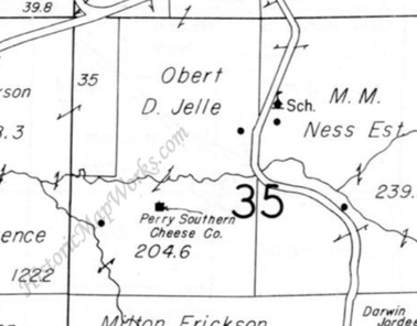
Picture
1954
Picture
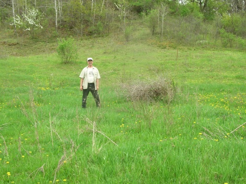
This location is closer to the map above. The land had obviously been disturbed. There was a distinct rectangular depression in the hillside and with scattered stones. Just to the west was a deep gully which drained into the creek below. This was probably the second site.
Operated: <1896 - >1954
Cheese Types: Brick, Swiss
Notes: Razed. Biennial report of the Dairy and Food Commissioner of WI: South Perry, Mt. Horeb RD 5 1909, Mt. Horeb PO 1913, Mt. Horeb RD 6 1922?. Perry PO 1896, Elvers 1898, Forward 1903, Blanchardville 1916, 1922, 1930.
Higher quality reproductions of some of the MHAHS's images are available for a small fee - contact our Research Center.
HOME
MUSEUM
     
Visiting Us
​      Exhibits
      Museum Gift Store
      Tours
      Facility Rental
      Photo Gallery
​
      Focus on Energy Award

     
​EVENTS 
    Current & Upcoming Events
    Ongoing Events      
    Past News Events     
RESEARCH
  
Finding your Regional Roots
   Location and contact Information
   ​Research and Genealogy Resources
   Oral History Project

   Services and Fees
​
​   Volunteering
   Donating Materials 

​ONLINE RESOURCES 
   1873 Plat Book Histories
   1928 Prairie Farmer's Directory
   Cemeteries   
   Century Farms
   Cheese Factories
   Churches
   Civil War
   Community Histories
   Combined Interactive Map
   Early Settlers of Donald Park Area
   Miller Report
   Mills

   Museum Collections (off site)
   Nat'l Historic Sites and Markers
   Past Times Newsletters 
   Post Offices
   Schools    
   ​William E. Keithley  
JOIN

​SUPPORTING US
Get Involved
​Financial Support
​33 Ways to Help

Memberships
Business and Corporate Memberships

Volunteer Opportunities
Gift Store
Virtual Store


​ABOUT US
History and Mission
Board of Directors  
Bylaws

Staff & Volunteers
​Contact us

LINKS
Architectural History Facebook Group
Join us on Facebook
​

The Mt. Horeb Area Historical Society controls copyrights to the images on this site. 
For permission to use these images please call 608.437.6486 or email mthorebmuseum@mhtc.net